 |
| USGS topo map legend |
We have no scientific proof, of course, but at the Antisocial Network we're convinced that if the first sentence in supposedly informative content contains the phrase "according to the... dictionary," there's a better than even chance that the content is total bull. Oh, it might be right, but that's probably only by accident. What's more likely is that it contains misinterpretation and misstatements galore. Take, for instance, Michael Keenan (sometimes known as Mike Keenan or Mark Kennan) writing "How to Use Map Scales," posted to – where else – eHow.com (it's since been moved to Sciencing.com). Mark's/Mike's first paragraph?
"According to the dictionary, a map scale is defined as 'a ratio which compares a measurement on a map to the actual distance between locations identified on the map.' Since it would be virtually impossible to create a life-size map, maps are scaled-down versions of real life. Using a map scale is important when you are trying to determine the actual distance represented on a map. Most map scales are in terms of miles per inch. The ratio between miles and inches will depend on how large an area the map is representing. For example, a map of the United States will have a much smaller scale than a map of a city, because the map of the city will show much greater detail."
We found the requisite "according to the dictionary" in the first line – it's at the very least superfluous. Then there's the "virtually impossible" in the second sentence: do you think it would be "virtually" impossible? or just plain "impossible" to make a "life-size" map? Why would you even need to make a life-size map? Plus, we would be remiss if we didn't point out to Kennan that map scales stated in miles per inch are pretty much unknown outside the USA. Duh.
|
|
We'd also be remiss if we didn't help Mr. Kennan out on a more technical point of terminology: if he's going to use "large scale" and "small scale" when referencing maps, he should get the difference right: "scale" doesn't refer to the amount of detail a map shows, it refers (in reverse) to the size of the area depicted. Large-scale maps cover small areas, small-scale maps cover large areas. Get it right or go home.
Not content to demonstrate dumbassery in just the introduction, however Mark continues (note the eHow-mandated "action verb" that opens the section):
"Determine the scale of the map. The scale can usually be found in a corner of the map and will tell you the ratio of the two units of measure. For example, the scale might have a line one inch long that represents 100 miles. Other scales might use a ratio to show the scale which shows how many real life units are represented by one map unit, such as how many inches in real life one inch on the map represents. For example, a ratio of 1:6,336,000 would mean that one inch on the map represented 6,336,000 inches, or 100 miles, of actual, real-life distance."
Eeeww:"actual, real-life distance"? eHow let him publish that rubbish? We have to wonder why Mark doesn't know the word "legend," either, but has to describe the "corner of the map." And then there's the whole "a ratio of 1:6,336,000 would mean that one inch on the map represented 6,336,000 inches, or 100 miles" bull. No map has ever stated a ratio scale of 1:6,336,000 - USGS 15-minute topographic maps are printed at a scale of 1:63360, or 1 inch per mile, but maps with a scale of 1 inch = 100 miles (if there are any) merely state "1 inch = 100 miles."
 |
| Map scale |
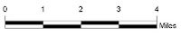
Casting about for padding, since he apparently hadn't reached the 300-word minimum mandated by eHow, Mark closed out his bullshit posting by telling us how to calculate an area by measuring our map. What Mark never bothers to do, however, is mention the type of map scales that were most likely the intended topic of the posting: the scale bar. Not. One. Word. Dumbass: Dumbass of the Day, in fact.
copyright © 2015-2023 scmrak
SI - MAPS
No comments:
Post a Comment